cuSpatial Python User’s Guide#
Contents#
Installing cuSpatial#
Read the RAPIDS Quickstart Guide to learn more about installing all RAPIDS libraries, including cuSpatial.
[ ]:
# !conda create -n rapids-24.08 -c rapidsai -c conda-forge -c nvidia \
#     cuspatial=24.08 python=3.9 cudatoolkit=11.5
If you wish to contribute to cuSpatial, you should create a source build using the excellent rapids-compose
GPU accelerated memory layout#
GeoArrow buffers, a GPU-friendly data format for geometric data that is well[1]:
# Imports used throughout this notebook.
import cuspatial
import cudf
import cupy
import geopandas
import os
import pandas as pd
import numpy as np
from shapely.geometry import *
from shapely import wkt
[2]:
# For deterministic result
np.random.seed(0)
cupy.random.seed(0)
Input / Output#
The primary method of loading features into cuSpatial is using cuspatial.from_geopandas.
__array_interface__ for coordinates and their feature offsets.cuspatial.from_geopandas#
The easiest way to get data into cuSpatial is via cuspatial.from_geopandas.
[3]:
host_dataframe = geopandas.read_file('https://naturalearth.s3.amazonaws.com/110m_cultural/ne_110m_admin_0_countries.zip')
host_dataframe = host_dataframe.set_crs(4326)
gpu_dataframe = cuspatial.from_geopandas(host_dataframe)
print(gpu_dataframe.head())
        featurecla  scalerank  LABELRANK                   SOVEREIGNT SOV_A3  \
0  Admin-0 country          1          6                         Fiji    FJI
1  Admin-0 country          1          3  United Republic of Tanzania    TZA
2  Admin-0 country          1          7               Western Sahara    SAH
3  Admin-0 country          1          2                       Canada    CAN
4  Admin-0 country          1          2     United States of America    US1

   ADM0_DIF  LEVEL               TYPE TLC                        ADMIN  ...  \
0         0      2  Sovereign country   1                         Fiji  ...
1         0      2  Sovereign country   1  United Republic of Tanzania  ...
2         0      2      Indeterminate   1               Western Sahara  ...
3         0      2  Sovereign country   1                       Canada  ...
4         1      2            Country   1     United States of America  ...

      FCLASS_TR     FCLASS_ID     FCLASS_PL FCLASS_GR  FCLASS_IT  \
0          None          None          None      None       None
1          None          None          None      None       None
2  Unrecognized  Unrecognized  Unrecognized      None       None
3          None          None          None      None       None
4          None          None          None      None       None

      FCLASS_NL FCLASS_SE  FCLASS_BD FCLASS_UA  \
0          None      None       None      None
1          None      None       None      None
2  Unrecognized      None       None      None
3          None      None       None      None
4          None      None       None      None

                                            geometry
0  MULTIPOLYGON (((180 -16.06713, 180 -16.55522, ...
1  POLYGON ((33.90371 -0.95, 34.07262 -1.05982, 3...
2  POLYGON ((-8.66559 27.65643, -8.66512 27.58948...
3  MULTIPOLYGON (((-122.84 49, -122.97421 49.0025...
4  MULTIPOLYGON (((-122.84 49, -120 49, -117.0312...

[5 rows x 169 columns]
(GPU)
Geopandas and cuDF integration#
GeoSeries is represented internally using GeoArrow data layout.cuDF.cuDF operation on cuSpatial non-feature columns, and most operations will workgeometry column. Operations that reduce or collate the number of rows in your DataFrame,groupby, are not supported at this time.[4]:
gpu_dataframe = cuspatial.from_geopandas(host_dataframe)
continents_dataframe = gpu_dataframe.sort_values("NAME")
print(continents_dataframe.head())
          featurecla  scalerank  LABELRANK   SOVEREIGNT SOV_A3  ADM0_DIF  \
103  Admin-0 country          1          3  Afghanistan    AFG         0
125  Admin-0 country          1          6      Albania    ALB         0
82   Admin-0 country          1          3      Algeria    DZA         0
74   Admin-0 country          1          3       Angola    AGO         0
159  Admin-0 country          1          4   Antarctica    ATA         0

     LEVEL               TYPE TLC        ADMIN  ... FCLASS_TR  FCLASS_ID  \
103      2  Sovereign country   1  Afghanistan  ...      None       None
125      2  Sovereign country   1      Albania  ...      None       None
82       2  Sovereign country   1      Algeria  ...      None       None
74       2  Sovereign country   1       Angola  ...      None       None
159      2      Indeterminate   1   Antarctica  ...      None       None

    FCLASS_PL FCLASS_GR  FCLASS_IT FCLASS_NL FCLASS_SE  FCLASS_BD FCLASS_UA  \
103      None      None       None      None      None       None      None
125      None      None       None      None      None       None      None
82       None      None       None      None      None       None      None
74       None      None       None      None      None       None      None
159      None      None       None      None      None       None      None

                                              geometry
103  POLYGON ((66.51861 37.36278, 67.07578 37.35614...
125  POLYGON ((21.02004 40.84273, 20.99999 40.58, 2...
82   POLYGON ((-8.6844 27.39574, -8.66512 27.58948,...
74   MULTIPOLYGON (((12.99552 -4.7811, 12.63161 -4....
159  MULTIPOLYGON (((-48.66062 -78.04702, -48.1514 ...

[5 rows x 169 columns]
(GPU)
cuspatial.GeoDataFrame and CPU-backedgeopandas.GeoDataFrame with from_geopandas and to_geopandas, enabling you toPolygon associated with the first item in the dataframe sorted[5]:
gpu_dataframe = cuspatial.from_geopandas(host_dataframe)
sorted_dataframe = gpu_dataframe.sort_values("NAME")
sorted_dataframe = sorted_dataframe.to_geopandas()
sorted_dataframe['geometry'].iloc[0]
[5]:

Trajectories#
LineString coupled with a time sample for each point in the LineString.cuspatial.trajectory.derive_trajectories to group trajectory datasets and sort by time.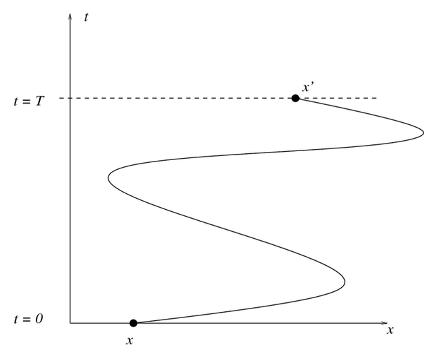
cuspatial.derive_trajectories#
[6]:
# 1m random trajectory samples
ids = cupy.random.randint(1, 400, 1000000)
timestamps = cupy.random.random(1000000)*1000000
xy= cupy.random.random(2000000)
trajs = cuspatial.GeoSeries.from_points_xy(xy)
sorted_trajectories, trajectory_offsets = \
    cuspatial.core.trajectory.derive_trajectories(ids, trajs, timestamps)
# sorted_trajectories is a DataFrame containing all trajectory samples
# sorted first by `object_id` and then by `timestamp`.
print(sorted_trajectories.head())
# trajectory_offsets is a Series containing the start position of each
# trajectory in sorted_trajectories.
print(trajectory_offsets)
   object_id         x         y               timestamp
0          1  0.680146  0.874341 1970-01-01 00:00:00.125
1          1  0.843522  0.044402 1970-01-01 00:00:00.834
2          1  0.837039  0.351025 1970-01-01 00:00:01.335
3          1  0.946184  0.479038 1970-01-01 00:00:01.791
4          1  0.117322  0.182117 1970-01-01 00:00:02.474
0           0
1        2455
2        4899
3        7422
4        9924
        ...
394    987408
395    989891
396    992428
397    994975
398    997448
Length: 399, dtype: int32
derive_trajectories sorts the trajectories by object_id, then timestamp, and returns acuspatial.trajectory_distances_and_speeds#
trajectory_distance_and_speed to calculate the overall distance travelled in meters andderive_trajectories.[7]:
trajs = cuspatial.GeoSeries.from_points_xy(
    sorted_trajectories[["x", "y"]].interleave_columns()
)
d_and_s = cuspatial.core.trajectory.trajectory_distances_and_speeds(
  len(cudf.Series(ids).unique()),
  sorted_trajectories['object_id'],
  trajs,
  sorted_trajectories['timestamp']
)
print(d_and_s.head())
                   distance        speed
trajectory_id
0              1.278996e+06  1280.320089
1              1.267179e+06  1268.370390
2              1.294437e+06  1295.905261
3              1.323413e+06  1323.956714
4              1.309590e+06  1311.561012
Bounding#
Compute the bounding boxes of n polygons or linestrings:

cuspatial.trajectory_bounding_boxes#
trajectory_bounding_boxes works out of the box with the values returned by derive_trajectories.[7]:
bounding_boxes = cuspatial.core.trajectory.trajectory_bounding_boxes(
  len(cudf.Series(ids, dtype="int32").unique()),
  sorted_trajectories['object_id'],
  trajs
)
print(bounding_boxes.head())
      x_min     y_min     x_max     y_max
0  0.000361  0.000170  0.999582  0.999485
1  0.000184  0.000647  0.999939  0.999884
2  0.000461  0.001395  0.999938  0.999297
3  0.000093  0.000073  0.999819  0.999544
4  0.000105  0.000112  0.999952  0.999013
cuspatial.polygon_bounding_boxes#
polygon_bounding_boxes supports more complex geometry objects such as Polygons with multiplepart_offset and ring_offset allows the function to use only the[8]:
single_polygons = cuspatial.from_geopandas(
    host_dataframe['geometry'][host_dataframe['geometry'].type == "Polygon"]
)
bounding_box_polygons = cuspatial.core.spatial.bounding.polygon_bounding_boxes(
    single_polygons
)
print(bounding_box_polygons.head())
        minx       miny       maxx       maxy
0  29.339998 -11.720938  40.316590  -0.950000
1 -17.063423  20.999752  -8.665124  27.656426
2  46.466446  40.662325  87.359970  55.385250
3  55.928917  37.144994  73.055417  45.586804
4  12.182337 -13.257227  31.174149   5.256088
cuspatial.linestring_bounding_boxes#
[9]:
lines = cuspatial.GeoSeries.from_linestrings_xy(
    trajs.points.xy, trajectory_offsets, cupy.arange(len(trajectory_offsets))
)
trajectory_bounding_boxes = cuspatial.core.spatial.bounding.linestring_bounding_boxes(
    lines, 0.0001
)
print(trajectory_bounding_boxes.head())
       minx      miny      maxx      maxy
0  0.000261  0.000070  0.999682  0.999585
1  0.000084  0.000547  1.000039  0.999984
2  0.000361  0.001295  1.000038  0.999397
3 -0.000007 -0.000027  0.999919  0.999644
4  0.000005  0.000012  1.000052  0.999113
Projection#
cuspatial.sinusoidal_projection#
[10]:
gpu_dataframe = cuspatial.from_geopandas(host_dataframe)
afghanistan = gpu_dataframe['geometry'][gpu_dataframe['NAME'] == 'Afghanistan']
points = cuspatial.GeoSeries.from_points_xy(afghanistan.polygons.xy)
projected = cuspatial.sinusoidal_projection(
    afghanistan.polygons.x.mean(),
    afghanistan.polygons.y.mean(),
    points
)
print(projected.head())
0     POINT (112.174 -281.59)
1     POINT (62.152 -280.852)
2     POINT (-5.573 -257.391)
3    POINT (-33.071 -243.849)
4     POINT (-98.002 -279.54)
dtype: geometry
Distance#
haversine and pairwise_linestring.hausdorff clustering distances algorithm is also available, computing the hausdorffcuspatial.directed_hausdorff_distance#
[11]:
coordinates = sorted_trajectories[['x', 'y']].interleave_columns()
spaces = cuspatial.GeoSeries.from_multipoints_xy(
    coordinates, trajectory_offsets
)
hausdorff_distances = cuspatial.core.spatial.distance.directed_hausdorff_distance(
    spaces
)
print(hausdorff_distances.head())
        0         1         2         3         4         5         6    \
0  0.000000  0.034755  0.031989  0.031959  0.031873  0.038674  0.029961
1  0.030328  0.000000  0.038672  0.032086  0.031049  0.032170  0.032275
2  0.027640  0.030539  0.000000  0.036737  0.033055  0.043447  0.028812
3  0.031497  0.033380  0.035224  0.000000  0.032581  0.035484  0.030339
4  0.031079  0.032256  0.035731  0.039084  0.000000  0.036416  0.031369

        7         8         9    ...       388       389       390       391  \
0  0.029117  0.040962  0.033259  ...  0.031614  0.036447  0.035548  0.028233
1  0.030215  0.034443  0.032998  ...  0.030594  0.035665  0.031473  0.031916
2  0.031807  0.039269  0.033250  ...  0.031998  0.033636  0.034646  0.032615
3  0.034792  0.045755  0.031810  ...  0.033623  0.031359  0.034923  0.032287
4  0.030388  0.033751  0.034029  ...  0.030705  0.040339  0.034328  0.029027

        392       393       394       395       396       397
0  0.034176  0.030057  0.033863  0.031111  0.034590  0.033850
1  0.037483  0.033489  0.041403  0.029784  0.035374  0.038179
2  0.036681  0.030642  0.038432  0.032481  0.034810  0.036695
3  0.032808  0.029771  0.040891  0.030802  0.032279  0.038443
4  0.035645  0.027703  0.037529  0.029356  0.031260  0.035501

[5 rows x 398 columns]
cuspatial.haversine_distance#
lon/lat ordering to better reflect the cartesian coordinates of great circlex/y.
[12]:
gpu_dataframe = cuspatial.from_geopandas(host_dataframe)
polygons_first = gpu_dataframe['geometry'][0:10]
polygons_second = gpu_dataframe['geometry'][10:30]

points_first = polygons_first.polygons.xy[0:1000]
points_second = polygons_second.polygons.xy[0:1000]

first = cuspatial.GeoSeries.from_points_xy(points_first)
second = cuspatial.GeoSeries.from_points_xy(points_second)

# The number of coordinates in two sets of polygons vary, so
# we'll just compare the first set of 1000 values here.
distances_in_meters = cuspatial.haversine_distance(
    first, second
)
cudf.Series(distances_in_meters).head()
[12]:
0    9959.695143
1    9803.166859
2    9876.857085
3    9925.097106
4    9927.268486
Name: None, dtype: float64
This above method reads the GeoPandas data from CPU memory into GPU memory and then cuSpatial processes it. If the data is already in a cuDF GPU dataframe, you can quickly calculate Haversine distances using the method below. This maximizes speed by keeping all the processing on the GPU and is very useful when working on large datasets.
[13]:
# Generate data to be used to create a cuDF dataframe.
# The data to be processed by Haversine MUST be a Float.
a = {"latitude":[17.1167, 17.1333, 25.333, 25.255, 24.433, 24.262, 35.317, 34.21, 34.566, 31.5, 36.7167, 30.5667, 28.05, 22.8, 35.7297, 36.97, 36.78, 36.8, 36.8, 36.72],
     "longitude": [-61.7833, -61.7833, 55.517, 55.364, 54.651, 55.609, 69.017, 62.228, 69.212, 65.85, 3.25, 2.8667, 9.6331, 5.4331, 0.65, 7.79, 3.07, 3.03, 3.04, 4.05]}
df = cudf.DataFrame(data=a)

# Create cuSpatial GeoSeries from cuDF Dataframe
cuGeoSeries = cuspatial.GeoSeries.from_points_xy(df[['longitude', 'latitude']].interleave_columns())

# Create Comparator cuSpatial GeoSeries from a comparator point
df['atlanta_lat'] = 33.7490
df['atlanta_lng'] = -84.3880
atlGeoSeries = cuspatial.GeoSeries.from_points_xy(df[['atlanta_lat', 'atlanta_lng']].interleave_columns())

# Calculate Haversine Distance of cuDF dataframe to comparator point
df['atlanta_dist'] = cuspatial.haversine_distance(cuGeoSeries, atlGeoSeries)
print(df.head())
   latitude  longitude  atlanta_lat  atlanta_lng  atlanta_dist
0   17.1167   -61.7833       33.749      -84.388  11961.556540
1   17.1333   -61.7833       33.749      -84.388  11963.392729
2   25.3330    55.5170       33.749      -84.388  12243.126130
3   25.2550    55.3640       33.749      -84.388  12233.867463
4   24.4330    54.6510       33.749      -84.388  12139.822218
Pairwise distance#
pairwise_linestring_distance computes the distance between a GeoSeries of Linestrings ofn and a corresponding GeoSeries of Linestrings of n length. It returns theThe input accepts a pair of geoseries as input sequences of linestring arrays.
naturalearth_lowres and treats them as linestrings.cuspatial.pairwise_linestring_distance#
[14]:
gpu_boundaries = cuspatial.from_geopandas(host_dataframe.geometry.boundary)
zeros = cuspatial.pairwise_linestring_distance(
    gpu_boundaries[0:50],
    gpu_boundaries[0:50]
)
print(zeros.head())
lines1 = gpu_boundaries[0:50]
lines2 = gpu_boundaries[50:100]
distances = cuspatial.pairwise_linestring_distance(
    lines1, lines2
)
print(distances.head())
0    0.0
1    0.0
2    0.0
3    0.0
4    0.0
dtype: float64
0    152.200610
1     44.076445
2      2.417269
3     44.197151
4     75.821029
dtype: float64
pairwise_point_linestring_distance computes the distance between pairs of points andcuspatial.pairwise_point_linestring_distance#
Using WGS 84 Pseudo-Mercator, distances are in meters.
[15]:
# Convert input dataframe to Pseudo-Mercator projection.
host_dataframe3857 = host_dataframe.to_crs(3857)
polygons = host_dataframe3857[host_dataframe3857['geometry'].type == "Polygon"]
gpu_polygons = cuspatial.from_geopandas(polygons)
# Extract mean_x and mean_y from each country
mean_x = [gpu_polygons['geometry'].iloc[[ix]].polygons.x.mean() for ix in range(len(gpu_polygons))]
mean_y = [gpu_polygons['geometry'].iloc[[ix]].polygons.y.mean() for ix in range(len(gpu_polygons))]
# Convert mean_x/mean_y values into Points for use in API.
points = cuspatial.GeoSeries([Point(point) for point in zip(mean_x, mean_y)])
# Convert Polygons into Linestrings for use in API.
linestring_df = cuspatial.from_geopandas(geopandas.geoseries.GeoSeries(
    [MultiLineString(mapping(polygons['geometry'].iloc[ix])["coordinates"]) for ix in range(len(polygons))]
))
gpu_polygons['border_distance'] = cuspatial.pairwise_point_linestring_distance(
    points, linestring_df
)
print(gpu_polygons.head())
         featurecla  scalerank  LABELRANK                        SOVEREIGNT  \
1   Admin-0 country          1          3       United Republic of Tanzania
2   Admin-0 country          1          7                    Western Sahara
5   Admin-0 country          1          3                        Kazakhstan
6   Admin-0 country          1          3                        Uzbekistan
11  Admin-0 country          1          2  Democratic Republic of the Congo

   SOV_A3  ADM0_DIF  LEVEL               TYPE TLC  \
1     TZA         0      2  Sovereign country   1
2     SAH         0      2      Indeterminate   1
5     KA1         1      1        Sovereignty   1
6     UZB         0      2  Sovereign country   1
11    COD         0      2  Sovereign country   1

                               ADMIN  ...     FCLASS_ID     FCLASS_PL  \
1        United Republic of Tanzania  ...          None          None
2                     Western Sahara  ...  Unrecognized  Unrecognized
5                         Kazakhstan  ...          None          None
6                         Uzbekistan  ...          None          None
11  Democratic Republic of the Congo  ...          None          None

   FCLASS_GR FCLASS_IT     FCLASS_NL FCLASS_SE FCLASS_BD  FCLASS_UA  \
1       None      None          None      None      None       None
2       None      None  Unrecognized      None      None       None
5       None      None          None      None      None       None
6       None      None          None      None      None       None
11      None      None          None      None      None       None

                                             geometry border_distance
1   POLYGON ((3774143.866 -105758.362, 3792946.708...     8047.288391
2   POLYGON ((-964649.018 3205725.605, -964597.245...   593137.492497
5   POLYGON ((9724867.413 6311418.173, 9640131.701...    37091.213890
6   POLYGON ((6230350.563 5057973.384, 6225978.591...   278633.467299
11  POLYGON ((3266113.592 -501451.658, 3286149.877...    35812.988244

[5 rows x 170 columns]
(GPU)
cuspatial.pairwise_point_polygon_distance#
Using WGS 84 Pseudo-Mercator, distances are in meters.
[16]:
countries = host_dataframe

cities = geopandas.read_file('https://naturalearth.s3.amazonaws.com/110m_cultural/ne_110m_populated_places_simple.zip')
cities = cities.to_crs(3857)

gpu_cities = cuspatial.from_geopandas(cities)
gpu_countries = cuspatial.from_geopandas(countries)
dist = cuspatial.pairwise_point_polygon_distance(
    gpu_cities.geometry[:len(gpu_countries)], gpu_countries.geometry
)

gpu_countries["distance_from"] = cities.name
gpu_countries["distance"] = dist

print(gpu_countries.head())
        featurecla  scalerank  LABELRANK                   SOVEREIGNT SOV_A3  \
0  Admin-0 country          1          6                         Fiji    FJI
1  Admin-0 country          1          3  United Republic of Tanzania    TZA
2  Admin-0 country          1          7               Western Sahara    SAH
3  Admin-0 country          1          2                       Canada    CAN
4  Admin-0 country          1          2     United States of America    US1

   ADM0_DIF  LEVEL               TYPE TLC                        ADMIN  ...  \
0         0      2  Sovereign country   1                         Fiji  ...
1         0      2  Sovereign country   1  United Republic of Tanzania  ...
2         0      2      Indeterminate   1               Western Sahara  ...
3         0      2  Sovereign country   1                       Canada  ...
4         1      2            Country   1     United States of America  ...

      FCLASS_PL  FCLASS_GR FCLASS_IT     FCLASS_NL  FCLASS_SE FCLASS_BD  \
0          None       None      None          None       None      None
1          None       None      None          None       None      None
2  Unrecognized       None      None  Unrecognized       None      None
3          None       None      None          None       None      None
4          None       None      None          None       None      None

  FCLASS_UA                                           geometry distance_from  \
0      None  MULTIPOLYGON (((180 -16.06713, 180 -16.55522, ...  Vatican City
1      None  POLYGON ((33.90371 -0.95, 34.07262 -1.05982, 3...    San Marino
2      None  POLYGON ((-8.66559 27.65643, -8.66512 27.58948...         Vaduz
3      None  MULTIPOLYGON (((-122.84 49, -122.97421 49.0025...       Lobamba
4      None  MULTIPOLYGON (((-122.84 49, -120 49, -117.0312...    Luxembourg

       distance
0  5.329915e+06
1  5.628613e+06
2  6.057264e+06
3  4.626961e+06
4  6.415631e+06

[5 rows x 171 columns]
(GPU)
cuspatial.pairwise_linestring_polygon_distance#
Using WGS 84 Pseudo-Mercator, distances are in meters.
[17]:
# all driveways within 2km range of central park, nyc

if not os.path.exists("./streets_3857.csv"):
    import osmnx as ox
    graph = ox.graph_from_point((40.769361, -73.977655), dist=2000, network_type="drive")
    nodes, streets = ox.graph_to_gdfs(graph)
    streets = streets.to_crs(3857)
    streets = streets.reset_index(drop=True)
    streets.index.name = "index"
    streets[["name", "geometry"]].to_csv("streets_3857.csv")

# The data is under notebooks/streets_3857.csv
streets = pd.read_csv("./streets_3857.csv", index_col="index")
streets.geometry = streets.geometry.apply(wkt.loads)
streets = geopandas.GeoDataFrame(streets)
streets.head()
[17]:
| name | geometry | |
|---|---|---|
| index | ||
| 0 | Columbus Avenue | LINESTRING (-8234860.077 4980333.535, -8234863... |
| 1 | West 80th Street | LINESTRING (-8235173.854 4980508.442, -8235160... |
| 2 | Amsterdam Avenue | LINESTRING (-8235173.854 4980508.442, -8235168... |
| 3 | West 80th Street | LINESTRING (-8235369.475 4980617.398, -8235347... |
| 4 | Broadway | LINESTRING (-8235369.475 4980617.398, -8235373... |
[19]:
# The polygon of the Empire State Building

if not os.path.exists("./esb_3857.csv"):
    import osmnx as ox
    esb = ox.features.features_from_place('Empire State Building, New York', tags={"building": True})
    esb = esb.to_crs(3857)
    esb = esb.geometry.reset_index(drop=True)
    esb.index.name = "index"
    esb.to_csv("esb_3857.csv")

# The data is under notebooks/esb_3857.csv
esb = pd.read_csv("./esb_3857.csv", index_col="index")
esb.geometry = esb.geometry.apply(wkt.loads)
esb = geopandas.GeoDataFrame(esb)
esb = pd.concat([esb.iloc[0:1]] * len(streets))
esb.head()
/raid/jlamb/miniforge/envs/cuspatial-dev/lib/python3.11/site-packages/osmnx/features.py:294: DeprecationWarning: The 'unary_union' attribute is deprecated, use the 'union_all()' method instead.
  polygon = gdf_place["geometry"].unary_union
[19]:
| geometry | |
|---|---|
| index | |
| 0 | POLYGON ((-8236139.639 4975314.625, -8235990.3... |
| 0 | POLYGON ((-8236139.639 4975314.625, -8235990.3... |
| 0 | POLYGON ((-8236139.639 4975314.625, -8235990.3... |
| 0 | POLYGON ((-8236139.639 4975314.625, -8235990.3... |
| 0 | POLYGON ((-8236139.639 4975314.625, -8235990.3... |
[20]:
# Straight line distance between the driveways to the Empire State Building
gpu_streets = cuspatial.from_geopandas(streets.geometry)
gpu_esb = cuspatial.from_geopandas(esb.geometry)

dist = cuspatial.pairwise_linestring_polygon_distance(gpu_streets, gpu_esb).rename("dist")
pd.concat([streets["name"].reset_index(drop=True), dist.to_pandas()], axis=1)
[20]:
| name | dist | |
|---|---|---|
| 0 | Columbus Avenue | 4993.583717 |
| 1 | West 80th Street | 5103.472213 |
| 2 | Amsterdam Avenue | 5208.373183 |
| 3 | West 80th Street | 5275.851781 |
| 4 | Broadway | 5178.999774 |
| ... | ... | ... |
| 1862 | West 82nd Street | 5411.762092 |
| 1863 | Broadway | 5476.345847 |
| 1864 | West 84th Street | 5613.403002 |
| 1865 | West 75th Street | 4750.092380 |
| 1866 | Broadway | 4638.894939 |
1867 rows × 2 columns
cuspatial.pairwise_polygon_distance#
Using WGS 84 Pseudo-Mercator, distances are in meters.
[21]:
african_countries = gpu_countries[gpu_countries.CONTINENT == "Africa"].sort_values("POP_EST", ascending=False)
asian_countries = gpu_countries[gpu_countries.CONTINENT == "Asia"].sort_values("POP_EST", ascending=False)
[22]:
# Straight line distance between the top 10 most populated countries in Asia and Africa
population_top10_africa = african_countries[:10].reset_index(drop=True)
population_top10_asia = asian_countries[:10].reset_index(drop=True)
dist = cuspatial.pairwise_polygon_distance(
    population_top10_africa.geometry, population_top10_asia.geometry)

cudf.concat([
    population_top10_africa["NAME"].rename("Africa"),
    population_top10_asia["NAME"].rename("Asia"),
    dist.rename("dist")], axis=1
)
[22]:
| Africa | Asia | dist | |
|---|---|---|---|
| 0 | Nigeria | China | 64.966620 |
| 1 | Ethiopia | India | 25.598868 |
| 2 | Egypt | Indonesia | 60.717434 |
| 3 | Dem. Rep. Congo | Pakistan | 37.489668 |
| 4 | South Africa | Bangladesh | 72.860545 |
| 5 | Tanzania | Japan | 97.872886 |
| 6 | Kenya | Philippines | 75.450451 |
| 7 | Uganda | Vietnam | 69.827567 |
| 8 | Algeria | Turkey | 17.927419 |
| 9 | Sudan | Iran | 13.990335 |
Filtering#
The filtering module contains points_in_spatial_window, which returns from a set of points only those points that fall within a spatial window defined by four bounding coordinates: min_x, max_x, min_y, and max_y. The following example finds only the points of polygons that fall within 1 standard deviation of the mean of all of the polygons.

cuspatial.points_in_spatial_window#
[23]:
gpu_dataframe = cuspatial.from_geopandas(host_dataframe)
geometry = gpu_dataframe['geometry']
points = cuspatial.GeoSeries.from_points_xy(geometry.polygons.xy)
mean_x, std_x = (geometry.polygons.x.mean(), geometry.polygons.x.std())
mean_y, std_y = (geometry.polygons.y.mean(), geometry.polygons.y.std())
avg_points = cuspatial.points_in_spatial_window(
    points,
    mean_x - std_x,
    mean_x + std_x,
    mean_y - std_y,
    mean_y + std_y
)
print(avg_points.head())
0       POINT (33.90371 -0.95)
1    POINT (34.07262 -1.05982)
2    POINT (37.69869 -3.09699)
3     POINT (37.7669 -3.67712)
4    POINT (39.20222 -4.67677)
dtype: geometry
With some careful grouping, one can reconstruct the original complete polygons that fall within the range.
Set Operations#
Linestring Intersections#
cuSpatial provides a linestring-linestring intersection algorithm to compute the overlapping geometries between two linestrings. The API also returns the ids for each returned geometry to help user to trace back the source geometry.
[24]:
from cuspatial.core.binops.intersection import pairwise_linestring_intersection

usa_boundary = cuspatial.from_geopandas(host_dataframe[host_dataframe.NAME == "United States of America"].geometry.boundary)
canada_boundary = cuspatial.from_geopandas(host_dataframe[host_dataframe.NAME == "Canada"].geometry.boundary)

list_offsets, geometries, look_back_ids = pairwise_linestring_intersection(usa_boundary, canada_boundary)
[25]:
# The first integer series shows that the result contains 1 row (since we only have 1 pair of linestrings as input).
# This row contains 144 geometires.
list_offsets
[25]:
<cudf.core.column.numerical.NumericalColumn object at 0x7f525c27a570>
[
  0,
  142
]
dtype: int32
[31]:
# The second element is a geoseries that contains the intersecting geometries, with 144 rows, including points and linestrings.
geometries
[31]:
0                            POINT (-130.53611 54.80275)
1                            POINT (-130.53611 54.80278)
2                            POINT (-130.53611 54.80275)
3                                 POINT (-129.98 55.285)
4                            POINT (-130.53611 54.80278)
                             ...
137                  LINESTRING (-120 49, -117.03121 49)
138                     LINESTRING (-122.84 49, -120 49)
139               LINESTRING (-117.03121 49, -107.05 49)
140    LINESTRING (-83.89077 46.11693, -83.61613 46.1...
141    LINESTRING (-82.69009 41.67511, -82.43928 41.6...
Length: 142, dtype: geometry
[26]:
# The third element is a dataframe that contains IDs to the input segments and linestrings, 4 for each result row.
# Each represents ids to lhs, rhs linestring and segment ids.
look_back_ids
[26]:
| lhs_linestring_id | lhs_segment_id | rhs_linestring_id | rhs_segment_id | |
|---|---|---|---|---|
| 0 | [8, 8, 8, 8, 8, 8, 8, 8, 8, 8, 8, 8, 8, 8, 8, ... | [18, 16, 18, 15, 17, 137, 14, 16, 13, 15, 14, ... | [0, 0, 0, 0, 0, 0, 0, 0, 0, 0, 0, 0, 0, 0, 0, ... | [9, 10, 10, 11, 11, 28, 12, 12, 13, 13, 14, 15... |
Spatial Joins#
cuSpatial provides a number of functions to facilitate high-performance spatial joins, including unindexed and quadtree-indexed point-in-polygon and quadtree-indexed point to nearest linestring.
The API for spatial joins does not yet match GeoPandas, but with knowledge of cuSpatial data formats you can call cuspatial.point_in_polygon for large numbers of points on 32 polygons or less, or call cuspatial.quadtree_point_in_polygon for large numbers of points and polygons.
Unindexed Point-in-polygon Join#
cuspatial.point_in_polygon#
[27]:
single_polygons = host_dataframe[host_dataframe['geometry'].type == "Polygon"]
gpu_dataframe = cuspatial.from_geopandas(single_polygons)
x_points = (cupy.random.random(10000000) - 0.5) * 360
y_points = (cupy.random.random(10000000) - 0.5) * 180
xy = cudf.DataFrame({"x": x_points, "y": y_points}).interleave_columns()
points = cuspatial.GeoSeries.from_points_xy(xy)

short_dataframe = gpu_dataframe.iloc[0:31]
geometry = short_dataframe['geometry']

points_in_polygon = cuspatial.point_in_polygon(
    points, geometry
)
sum_of_points_in_polygons_0_to_31 = points_in_polygon.sum()
sum_of_points_in_polygons_0_to_31.head()
[27]:
1     11896
2      1268
5     50835
6      7792
11    29318
dtype: int64
quadtree_point_in_polygon that uses an indexingquadtree_point_in_polygon also supports a number ofQuadtree Indexing#
The indexing module is used to create a spatial quadtree. Use
cuspatial.quadtree_on_points(
    points,
    x_min,
    x_max,
    y_min,
    y_max,
    scale,
    max_depth,
    max_size
)
quadtree_point_in_polygonjoin module.scale: A scaling function that increases the size of the point space from an{x_min, y_min}. This can increase the likelihood of generatingmax_depth: In order for a quadtree to index points effectively, it must have a depth that is log-scaled with the size of the number of points. Each level of themax_depth parameter. With an input size10m points and max_depth = 7, \(\frac{10^6}{4^7}\) points will be mostmax_size: The maximum number of points allowed in an internal node before it is split into four leaf notes. As the quadtree is generated, a leaf node containing usable index points will be created as points are added. If the number of points in this leaf exceeds max_size, the leaf will be subdivided, with four new leaves added and the original node removed from the set of leaves. This number is probably optimized in most datasets by making it a significant fraction of the optimal leaf
size computation from above. Consider \(10,000,000 / 4^7 / 4 = 153\).
cuspatial.quadtree_on_points#
[28]:
x_points = (cupy.random.random(10000000) - 0.5) * 360
y_points = (cupy.random.random(10000000) - 0.5) * 180
xy = cudf.DataFrame({"x": x_points, "y": y_points}).interleave_columns()
points = cuspatial.GeoSeries.from_points_xy(xy)

scale = 5
max_depth = 7
max_size = 125
point_indices, quadtree = cuspatial.quadtree_on_points(points,
                                                       x_points.min(),
                                                       x_points.max(),
                                                       y_points.min(),
                                                       y_points.max(),
                                                       scale,
                                                       max_depth,
                                                       max_size)
print(point_indices.head())
print(quadtree.head())
0     1507
1     1726
2     4242
3     7371
4    11341
dtype: uint32
   key  level  is_internal_node  length  offset
0    0      0              True       4       2
1    1      0              True       2       6
2    0      1              True       4       8
3    1      1              True       4      12
4    2      1              True       2      16
Indexed Spatial Joins#
The quadtree spatial index (point_indices and quadtree) is used by quadtree_point_in_polygon and quadtree_point_to_nearest_linestring to accelerate larger spatial joins. quadtree_point_in_polygon depends on a number of intermediate products calculated here using the following functions.
cuspatial.join_quadtree_and_bounding_boxes#
cuspatial.quadtree_point_in_polygon#
[29]:
polygons = gpu_dataframe['geometry']

poly_bboxes = cuspatial.polygon_bounding_boxes(
    polygons
)
intersections = cuspatial.join_quadtree_and_bounding_boxes(
    quadtree,
    poly_bboxes,
    polygons.polygons.x.min(),
    polygons.polygons.x.max(),
    polygons.polygons.y.min(),
    polygons.polygons.y.max(),
    scale,
    max_depth
)
polygons_and_points = cuspatial.quadtree_point_in_polygon(
    intersections,
    quadtree,
    point_indices,
    points,
    polygons
)
print(polygons_and_points.head())
Empty DataFrame
Columns: [polygon_index, point_index]
Index: []
cuspatial.quadtree_point_to_nearest_linestring#
cuspatial.quadtree_point_to_nearest_linestring can be used to find the Polygon or Linestring[30]:
gpu_countries = cuspatial.from_geopandas(countries[countries['geometry'].type == "Polygon"])
gpu_cities = cuspatial.from_geopandas(cities[cities['geometry'].type == 'Point'])
[31]:
polygons = gpu_countries['geometry'].polygons

boundaries = cuspatial.GeoSeries.from_linestrings_xy(
    cudf.DataFrame({"x": polygons.x, "y": polygons.y}).interleave_columns(),
    polygons.ring_offset,
    cupy.arange(len(polygons.ring_offset))
)

point_indices, quadtree = cuspatial.quadtree_on_points(gpu_cities['geometry'],
                                                       polygons.x.min(),
                                                       polygons.x.max(),
                                                       polygons.y.min(),
                                                       polygons.y.max(),
                                                       scale,
                                                       max_depth,
                                                       max_size)
poly_bboxes = cuspatial.linestring_bounding_boxes(
    boundaries,
    2.0
)
intersections = cuspatial.join_quadtree_and_bounding_boxes(
    quadtree,
    poly_bboxes,
    polygons.x.min(),
    polygons.x.max(),
    polygons.y.min(),
    polygons.y.max(),
    scale,
    max_depth
)
result = cuspatial.quadtree_point_to_nearest_linestring(
    intersections,
    quadtree,
    point_indices,
    gpu_cities['geometry'],
    boundaries
)
print(result.head())
Empty DataFrame
Columns: [point_index, linestring_index, distance]
Index: []
Images used with permission from Wikipedia Creative Commons
[ ]: